Full semantic labels

Due to the nature of synthetically generating ground truth data, each simulated laser beam returns the exact object id that it has hit. This allows us to obtain perfect, non-ambiguous labels. We categories each object into one of nine classes.

Realistic

Our dataset starts from a highly realistic 3D model. A high poly count is chosen for realistic detailed geometry. Rich texture maps give the model realistic spectral properties.

Full RGB colour

Our dataset contains RGB data for each point. We also provide the gps time for each individual measurement as well as a binary end of line indicator to enable single scan line processing easily.

General information about SynthCity

With deep learning becoming a more prominent approach for automatic classification of three-dimensional point cloud data, a key bottleneck is the amount of high quality training data, especially when compared to that available for two-dimensional images. One potential solution is the use of synthetic data for pre-training networks, however the ability for models to generalise from synthetic data to real world data has been poorly studied for point clouds. Despite this, a huge wealth of 3D virtual environments exist, which if proved effective can be exploited. We therefore argue that research in this domain would be hugely useful. In this paper we present SynthCity an open dataset to help aid research. SynthCity is a 367.9M point synthetic full colour Mobile Laser Scanning point cloud. Every point is labelled from one of nine categories. We generate our point cloud in a typical Urban/Suburban environment using the BlenSor plugin for Blender.

Number of points per class and area.

1
14,355K
591K
372K
503K
239K
26,410K
198K
1,034K
2,532K
46.23M
2
12,241K
1,123K
526K
832K
248K
32,818K
97K
1,707K
2,981K
52.57M
3
16,222K
915K
186K
712K
206K
26,521K
227K
866K
2,546K
48.40M
4
14,767K
510K
563K
622K
175K
25,111K
415K
1,673K
2,800K
46.64M
5
11,424K
909K
897K
593K
256K
29,239K
92K
2,358K
2,982K
48.75M
6
16,521K
709K
918K
1,034K
174K
26,782K
365K
2,234K
3,184K
51,92M
7
1,895K
226K
330K
272K
83K
11,178K
22K
568K
938K
15.51M
8
4,833K
544K
607K
984K
171K
25,914K
36K
962K
2,702K
36.75M
9
5,716K
381K
390K
656K
84K
11,897K
19K
687K
1,321K
21.15M
Total
97.97M
4.78M
12.09M
6.21M
21.99M
215.87M
1.47M
5.91M
1.64M
367.95M

Further information

Future iterations

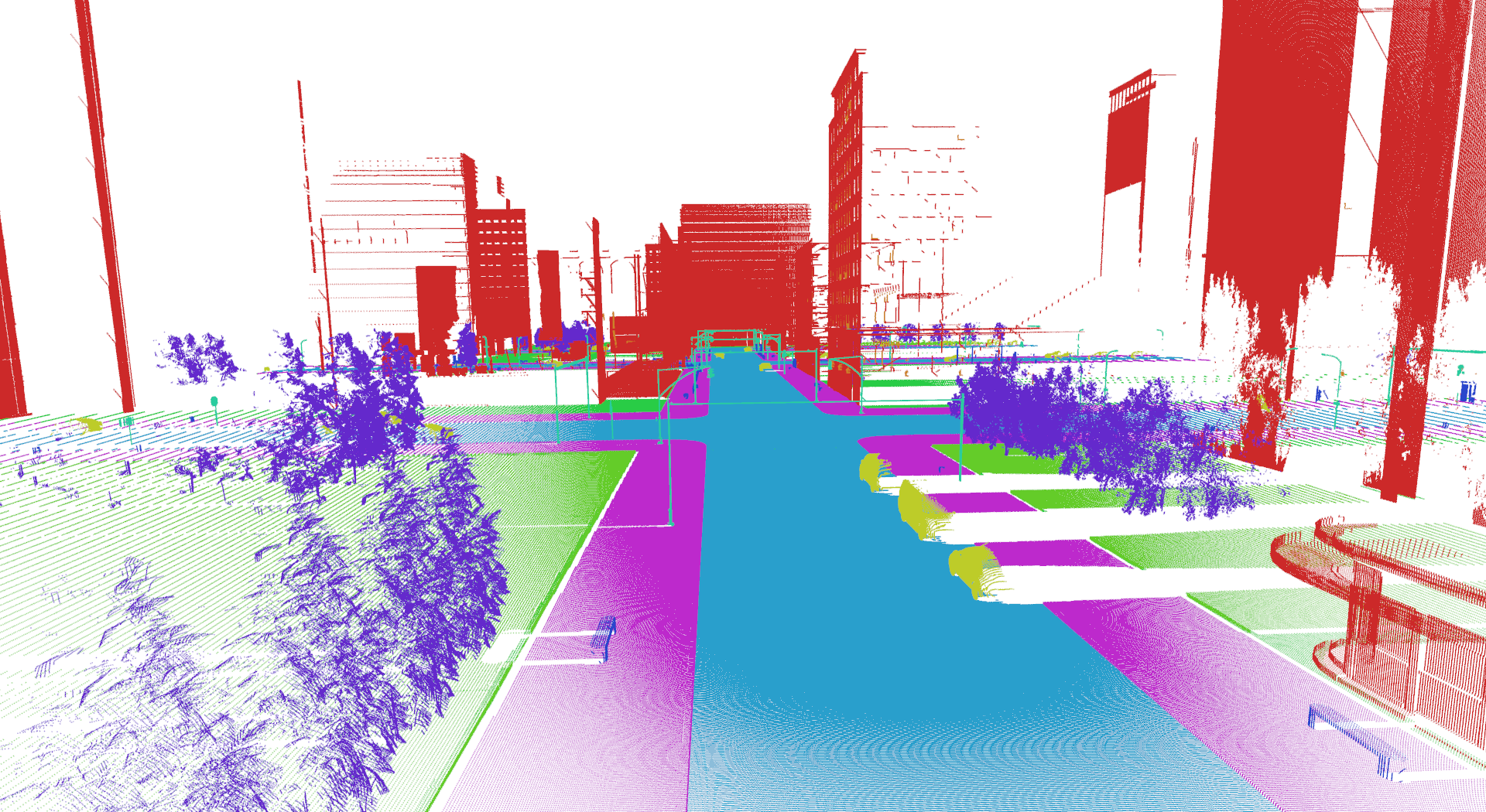
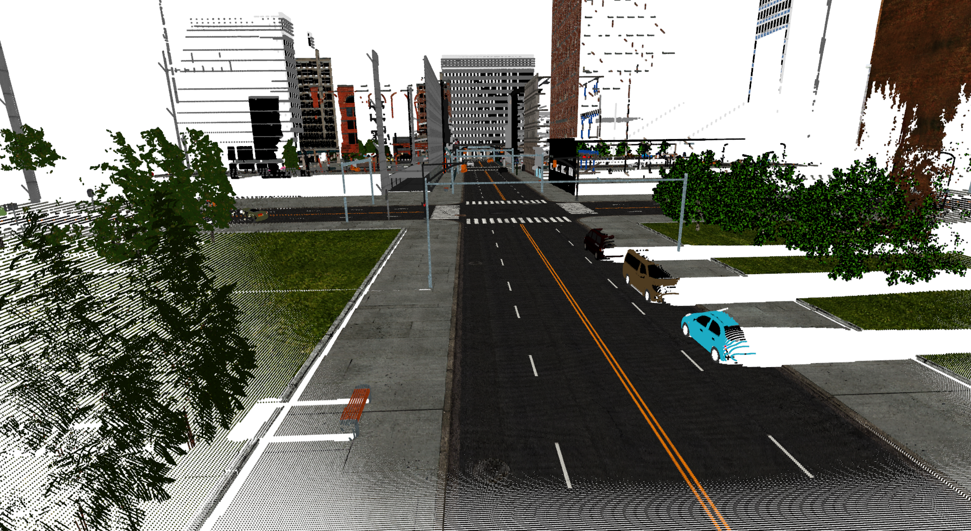
Whilst SynthCity has been rendered to simulate a Mobile Laser Scanner (MLS). Blensor supports the ability scan with a range of scanners, most notably a simulated Velodyne scanner. Such scanners are commonly used for both MLS systems and autonomous vehicles. Re-rendering with a Velodyne scanner would only require the AWS instances to be run again to produce the equivalent point cloud. If you are interested in sponsoring further rendering of the synthetic city please contact us using the details at the bottom of this page.